10 Most Beautiful Places in California, From the Redwoods to the Desert
The most beautiful places in California include Yosemite National Park, Big Sur, Lake Tahoe, Sequoia & Kings Canyon National Parks, Joshua Tree National Park, Death Valley, Redwood National and State Parks, Point Reyes National Seashore, Channel Islands National Park, and Point Lobos State Natural Reserve. California stands out because it combines coast, scenic mountains, deserts, lakes, and giant forests in one state.
California feels like the world’s best geography lesson: in a few hours you can go from sea-level beaches to snowy mountain peaks, ancient redwood forests to sunbaked desert. Out of all the US states, no other state in America offers this variety – not even close. The Pacific coastline stretches about 840 miles from the Oregon border to Mexico, sweeping from misty coastal redwoods in the north to sun-drenched sandy beaches in the south. Inland, towering granite peaks rise above productive valleys, but a two-hour drive can land you in a completely different world: two hours north of Los Angeles, for example, you can be surrounded by mossy redwood cathedrals and thundering waterfalls; two hours east brings windswept chaparral, high mountain meadows, or volcanic high country. No single trip covers it all, which is part of the state’s charm. This guide is a tour of California’s most beautiful places with practical advice to turn a good trip into an unforgettable one.
What are the Most Beautiful Places in California?
The most beautiful places in California are:
- Yosemite National Park: Granite cliffs, famous waterfalls, alpine scenery, and ancient sequoia groves
- Big Sur: Roughly 90 miles of dramatic coastline where the Santa Lucia Mountains meet the Pacific Ocean
- Lake Tahoe: A high-elevation alpine lake straddling California and Nevada, known for clear blue water and mountain scenery
- Sequoia and Kings Canyon National Parks: Home to giant sequoias, including the world’s largest tree by volume
- Joshua Tree National Park: a distinctive desert landscape where the Mojave and Colorado Desert ecosystems meet
- Death Valley National Park: A vast landscape of salt flats, sand dunes, colorful badlands, mountains, and North America’s lowest point
- Redwood National and State Parks: Ancient coastal forests protecting the world’s tallest trees
- Channel Islands National Park: Remote islands with sea caves, dramatic cliffs, marine wildlife, and endemic species
- Point Lobos State Natural Reserve: Rugged coastal headlands with hidden coves, tide pools, Monterey cypress, and sweeping Pacific views
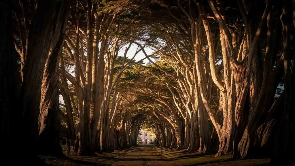
- Point Reyes National Seashore: Wind-sculpted headlands, beaches, wildlife, cypress-lined landscapes, and a historic lighthouse overlooking the Pacific
Each destination offers a completely different landscape. Together, they show why California consistently ranks alongside dreamy US cities and iconic travel spots as one the most geographically diverse destinations on Earth.
Yosemite National Park
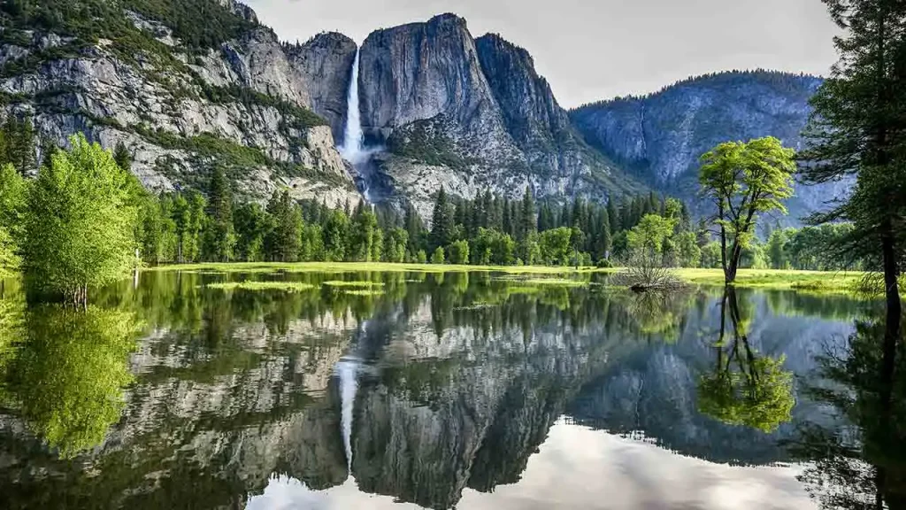
Yosemite is the destination most travelers list first, and it earns that position. The valley itself is compact – seven miles long, one mile wide. Yet, the scale of what surrounds it is staggering. El Capitan, the largest exposed granite monolith on Earth, rises 3,593 feet from valley floor to summit. Half Dome’s profile, sliced cleanly on its north face by glacial action, climbs 4,737 feet above the valley. Bridalveil Fall drops 620 feet (189 meters). Yosemite Falls reaches 2,425 feet of total drop, making it one of the highest waterfalls in North America.
- Best viewpoints: Tunnel View offer the classic wide shot of the valley arriving from the west. Valley View showcases El Capitan reflected in the Merced River in spring. Glacier Point acts as a 3,214-foot overlook where Half Dome appears at eye level while the valley floor lies 3,000 feet below.
- Top experiences: You can enjoy a flat valley floor walk or tackle the Mirror Lake loop. Spotting mule deer grazing in meadows at dusk provides a quiet thrill. Sunrise from Valley View in May shows the Merced River running high. February visitors might catch the Firefall phenomenon when the setting sun turns Horsetail Fall into what appears to be flowing lava.
- Best time to visit: May and June offer peak waterfall flow. September and October bring golden oak foliage alongside significantly lighter crowds. Avoid July and August weekends.
- Photography: Shoot Tunnel View at dawn when valley light goes warm. The Valley View reflection is best April through June. Visit Glacier Point at sunset for alpenglow on Half Dome.
- Who will love it: Everyone benefits from Yosemite. First-time visitors should plan three full days minimum to move beyond the valley floor. Serious hikers have 800 miles of trail. Families do well on the Mirror Lake loop and the Lower Yosemite Fall trail. It is also a favorite for couples seeking picturesque honeymoon destinations surrounded by iconic granite landscapes.
- Insider tip: Arrive at trailheads before 7:30 a.m. The difference between 7:30 and 10:00 a.m. at Yosemite Valley in summer is dramatic. Use the free valley shuttle instead of driving. Parking lots fill before 9 a.m. on summer weekends.
Sequoia & Kings Canyon National Park
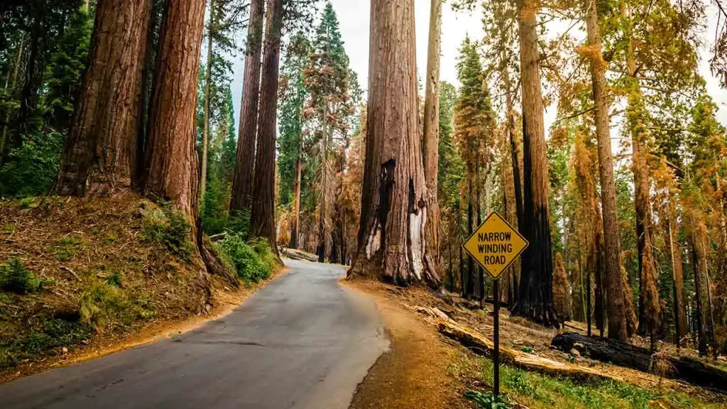
Sequoia offers a complete reset of your sense of scale. The General Sherman Tree stands 274.9 feet tall with a base diameter of 36.5 feet. It holds the title of the largest living thing on Earth by volume. Its lowest branch alone is more than six feet in diameter. Walking into the Giant Forest grove and tilting your head back to find the top of a mature sequoia is one of those experiences that doesn’t photograph well but stays with you.
The Giant Forest protects five of the world’s ten largest trees by volume. The bark glows a deep cinnamon-red. Filtered light reaches the understory from 200 feet above. The forest floor feels soft underfoot while remaining uniquely quiet compared to typical woodlands.
The canyon carved by the Kings River reaches depths exceeding 8,200 feet in some sections. It is comparable in vertical relief to the Grand Canyon. However, it remains far less visited and highly undeveloped.
Grant Grove holds the General Grant Tree. This specimen ranks as the second-largest tree by volume globally. Congress officially designated it as the “Nation’s Christmas Tree.” Cedar Grove, at the bottom of Kings Canyon along the Kings River, is one of the Sierra’s most peaceful valley environments. It is green, quiet, and surrounded by granite walls on three sides.
- Don’t miss: The Kings Canyon Scenic Byway (Highway 180) winding down into Cedar Grove. The drive drops directly through dramatic canyon walls from the Grant Grove level. It is entirely worth the round trip even if you just turn around at Road’s End.
- Beyond the trees: Moro Rock, a granite dome accessible via a quarter-mile staircase, offers panoramic Sierra views. Crystal Cave, a marble cavern open for guided tours in summer, provides underground contrast to the forest above. Tunnel Log, a fallen sequoia with a road cut through it, is a unique photo stop.
- Best time to visit: July through September when all roads are open. The Generals Highway can be snow-covered from October through May. Rangers periodically closes this route to large vehicles in winter.
- Who will love it: Tree enthusiasts of all ages. Children are reliably awed by sequoias in a way that outdoor destinations don’t always achieve. Hikers seeking less crowded alternatives to Yosemite find Sequoia genuinely quieter.
Redwood National and State Parks
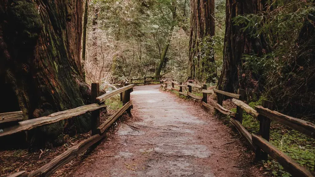
The coast redwood is the world’s tallest tree species. Hyperion, the tallest documented individual, stands over 380 feet in a grove inside this park system. The old-growth forest along California’s far north coast holds the last significant stands of trees that once covered two million acres of the Pacific Coast. Logging operations removed 95% of the original old-growth during the 19th and early 20th centuries.
This national park operates jointly with Prairie Creek Redwoods State Park. Del Norte Coast and Jedediah Smith state parks also form part of this contiguous protected corridor. This partnership creates a contiguous protected corridor. Lady Bird Johnson Grove and the Drury Scenic Parkway provide immediate access to old-growth forest without permits. Conversely, the Tall Trees Grove requires a permit-controlled access managed by the park to protect the documented tallest specimens.
- Fern Canyon at Prairie Creek: This is a narrow gorge where the walls on both sides are covered entirely in five-fingered ferns from floor to rim. Home Creek carved this path straight through the sedimentary layers over millennia. Spielberg filmed scenes from The Lost World: Jurassic Park here. It is one of the most unusual natural environments in California.
- Best time to visit: Year-round. Spring and fall deliver lush green conditions. Summer fog is typical on this section of the coast. Winter rain intensifies the forest’s deep green saturation and almost eliminates crowds.
- Who will love it: Nature lovers seeking genuine solitude. Photographers who understand what diffused coastal light does to forest canopies also thrive here.
Joshua Tree National Park
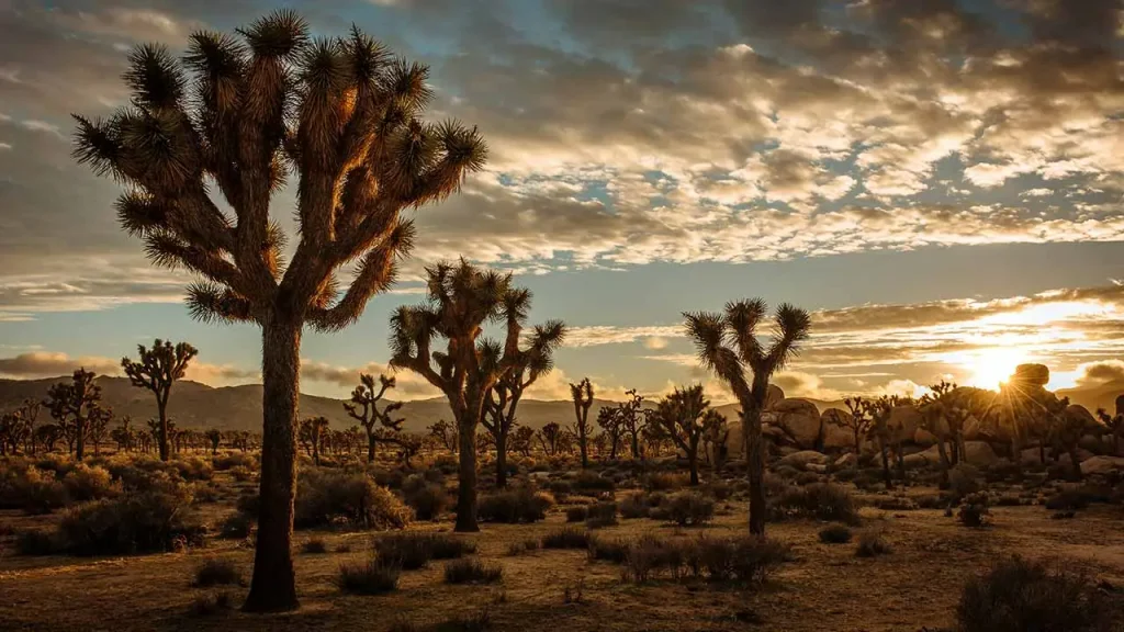
Joshua Tree feels most powerful right at the intersections. You can stand exactly where two distinct desert ecosystems collide. The park covers nearly 790,600 acres. It spans the higher Mojave Desert in the west while dipping into the lower Colorado Desert in the east.
These famous Joshua trees grow at highly eccentric angles and branch out unpredictably. They cluster into dense stands that look almost comedic under the harsh midday sun. The Wonderland of Rocks section around Hidden Valley contains some of the best rock climbing in North America. Climbers have established over 8,000 distinct routes here.
- Best viewpoints: Keys View sits at 5,185 feet. It offers clear sightlines straight across the Coachella Valley toward the Salton Sea. Arc Rock provides the perfect foreground for sunset silhouette shots. The Cholla Cactus Garden looks incredible in the late afternoon when the translucent cactus spines catch the backlit sun.
- Best time to visit: October through April. Summer temperatures exceed 110°F regularly, making hiking highly dangerous. Spring wildflower blooms (March-April in wet years) are exceptional during wet years. The park also holds an official International Dark Sky designation. Winter nights offer flawless astrophotography conditions if you can handle the freezing temperatures.
- Who will love it: Rock climbers, night-sky photographers and travelers planning relaxing trips or looking for peaceful babymoon destinations during the mild winter months. Desert hikers seeking extreme environments will find plenty of challenges.
Death Valley National Park
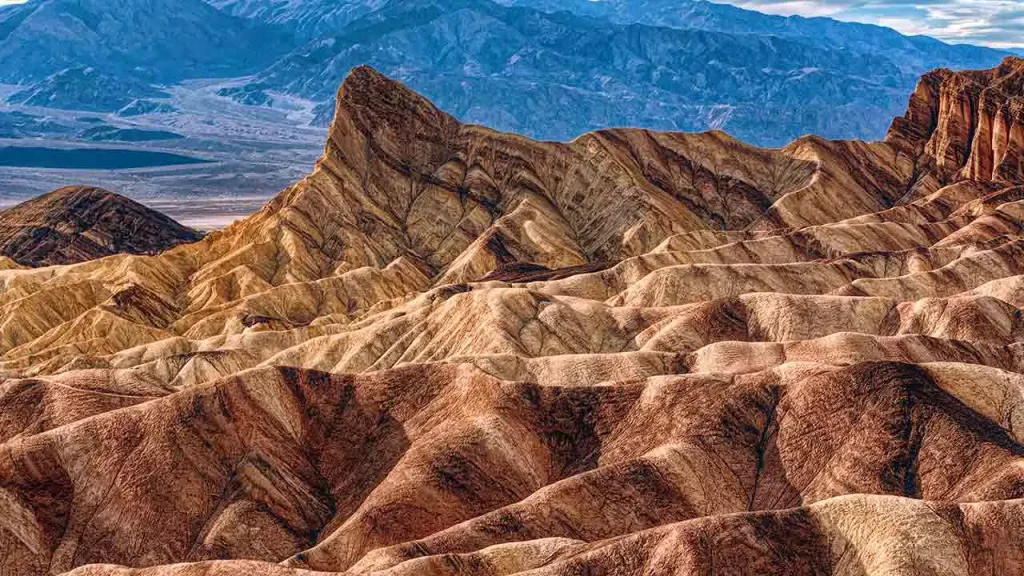
Death Valley is a landscape defined entirely by extremes. It holds the lowest point in North America at Badwater Basin, sitting 282 feet below sea level. It also recorded the long-accepted hottest air temperature on Earth at 134°F in 1913, though recent study challenges the exact measurement. The region receives less than two inches of annual rainfall.
These extremes sound hostile. Yet they produce geological variety concentrated in a single park that borders on the extraordinary. The colored badlands, salt polygons, volcanic craters, sand dune fields, and canyon walls painted in multiple mineral colors make it the most geologically diverse national park in California. Expansive sand dune fields add to this stark visual contrast.
- Zabriskie Point: A short walk from the parking area delivers a panorama of eroded badlands. These ridges turn from gold to deep orange to purple in the hour before and after sunrise. It stands as one of the most reliable landscape photography spots in the American West.
- Artists Drive and Artists Palette: A 9-mile one-way scenic road through volcanic hills painted in reds, yellows, pinks, and greens. Different mineral oxidations cause these intense color variations. It is easily one of the most reliable landscape photography spots
- Mesquite Flat Sand Dunes: This is the park’s most accessible dune field. The highest peaks rise roughly 100 feet. You should aim to arrive before 9 a.m. Early morning shadows deeply define the dune ridges before the heat becomes unmanageable.
- Best time to visit: November through March. Summer is possible if activity is confined to before 10 a.m. and after 5 p.m. You must carry extreme amounts of water for any hike. Park rangers recommend a minimum of one gallon per person.
- Who will love it: Landscape photographers looking for bucket-list sunrise shots. Winter travelers seeking warmth also gravitate toward this arid basin.
Big Sur
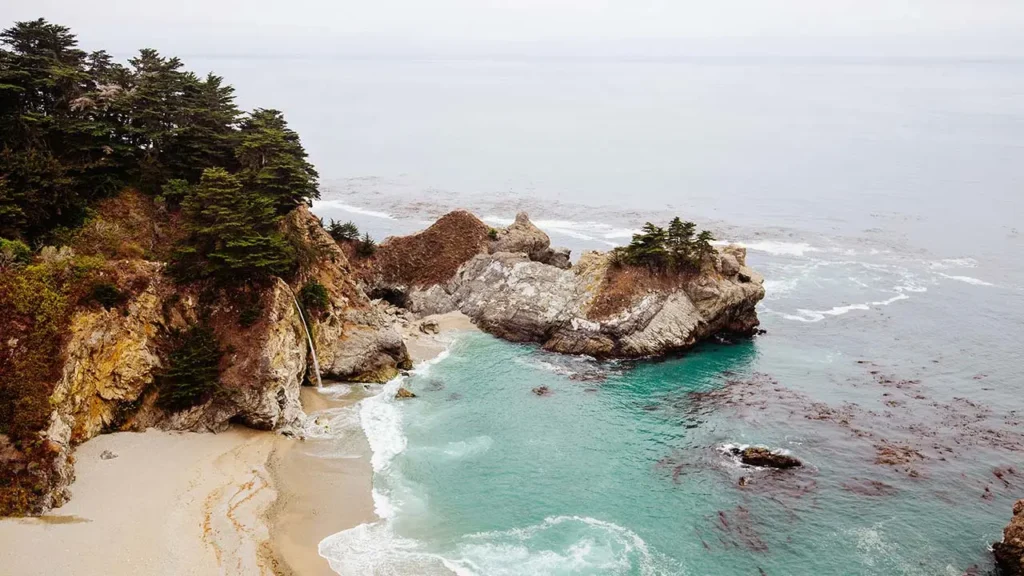
Big Sur is not a town. It represents a stretch of Highway 1 running 90 miles between San Simeon to the south and Carmel to the north. The geological drama here is so extreme it demands frequent stops. The Santa Lucia Mountains push directly into the Pacific along this corridor. This collision creates cliffs that rise hundreds of feet from the water’s edge, with the highway literally carved into their face.
What distinguishes Big Sur from other scenic drives is that the scale and the detail reward attention equally. Pull off at any of dozens of turnouts to find spectacular close-range features. You might spot sea stacks or natural rock arches. Cove beaches sit hidden below, accessible only by rope. Sea otters float in kelp beds offshore, matching the grandeur of the long highway views.
- Bixby Bridge: The concrete arch bridge built in 1932 spans a canyon 260 feet above Bixby Creek. Both the north and south approaches have pullouts for the classic photograph. Walk out on the bridge itself for the view down the canyon toward the water.
- McWay Falls: An 80-foot waterfall inside Julia Pfeiffer Burns State Park that drops directly onto the beach below. It remains one of only two tide-fall waterfalls in California. The half-mile Overlook Trail reaches the viewpoint from the parking area. The beach below is not accessible, which keeps it pristine.
- Pfeiffer Beach: Reached via the unmarked Sycamore Canyon Road 0.7 miles south of Big Sur Station. GPS is strictly required, and the road cannot accommodate RVs. Purple-tinged sand forms from manganese garnet erosion. A natural rock arch frames the sunset perfectly between November and January. Visitors should expect a separate day-use parking fee at Pfeiffer Beach
- Point Sur State Historic Park: A volcanic rock promontory rising 361 feet from a sand spit. It is topped by a lighthouse that has remained operational since 1889. Accessible only by guided tour from the parking area below.
- Best time to visit: April-May and September-October for clearest visibility and best weather. Summer fog can reduce Big Sur to a gray corridor. Some visitors drive the entire route during July and see nothing but clouds. Winter brings powerful surf and dramatic skies.
- Practical note: Highway 1 through Big Sur is subject to closures from slides and storm damage. Always check Caltrans road conditions (dot.ca.gov) before departure.
Channel Islands National Park
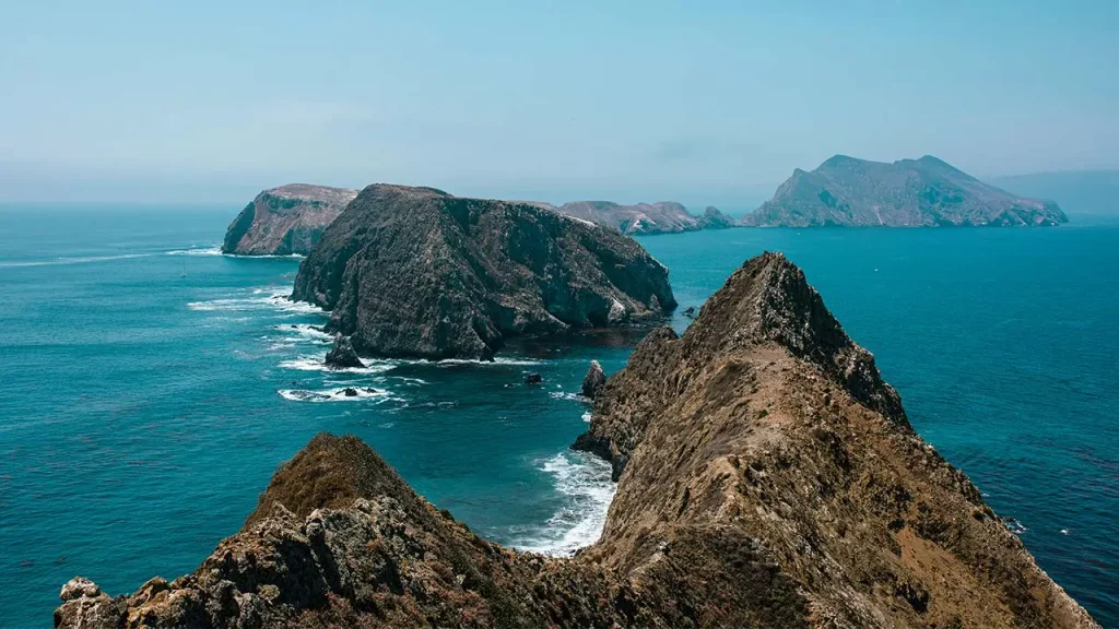
Five islands off the coast between Ventura and Santa Barbara. They remain accessible only by boat or small plane from Island Packers in Ventura. The islands were connected to the mainland during ice ages, then isolated by rising sea levels. This separation lasted long enough for distinct subspecies to evolve independently. The island fox (recovered from near-extinction in the 1990s. The island scrub-jay lives literally nowhere else on Earth.
Santa Cruz Island is the largest and most visited landmass in the chain. It offers meadows of endemic wildflowers alongside steep sea cliffs. The Painted Cave serves as one of the world’s largest sea caves, accessible by kayak. Kelp forest diving and snorkeling around all five islands ranks among California’s best. Day trips are feasible from Ventura; camping is available on all five islands.
- Best time: Spring for wildflowers. Winter offers excellent whale watching opportunities during the boat crossing.
Point Reyes National Seashore
Landscape artist Francis McComas famously called Point Lobos “the greatest meeting of land and water in the world.” Located just south of Carmel, this headland reserve packs staggering biodiversity into a highly condensed coastal footprint. Marked by charming, walkable paths reminiscent of historic small towns, Point Lobos is defined by its intimate, hidden coves and jagged, wave-battered rocks.
The landscape ranges from dense Douglas fir forest on the eastern ridges to the exposed, wind-battered headlands on the west. Point Reyes Lighthouse – perched at the outermost tip of the peninsula 300 feet above the sea. It receives more fog than nearly any other West Coast location. When clear, views extend north to the Russian River mouth.
- Tule elk at Tomales Point: A free-roaming herd of tule elk occupies the northern end of the seashore. Hikers can safely observe these large animals via the Tomales Point Trail. In fall, males bugle and spar with antlers, audible from the trail.
- Best time to visit: Year-round. Wildflowers in spring. Gray whale watching from the lighthouse bluffs in winter. Summer fog is heavy but creates atmospheric forest photography.
Point Lobos State Natural Reserve
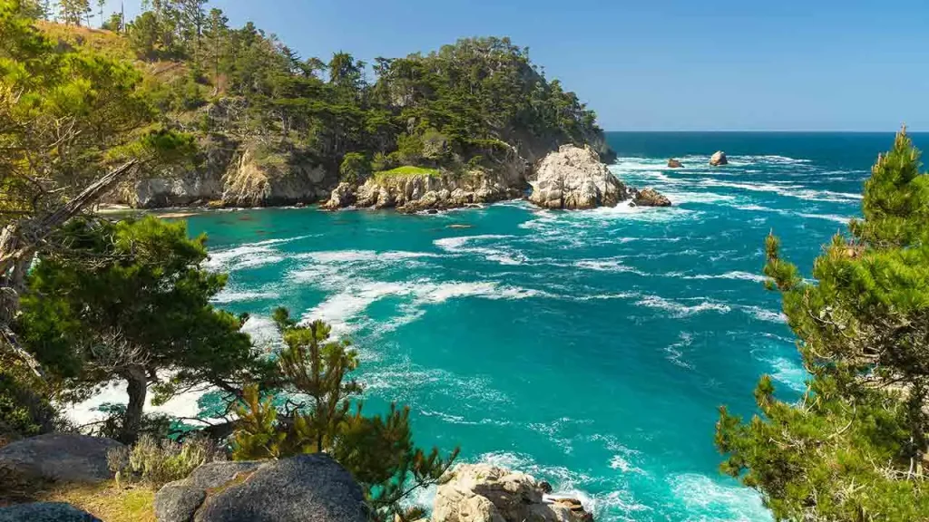
Landscape artist Francis McComas famously called Point Lobos “the greatest meeting of land and water in the world.” Located just south of Carmel, this headland reserve packs staggering biodiversity into a highly condensed coastal footprint. Unlike the sweeping, massive cliffs of Big Sur to the south, Point Lobos is defined by its intimate, hidden coves and jagged, wave-battered rocks.
The reserve protects one of only two naturally occurring stands of Monterey cypress trees remaining on Earth. The Cypress Grove Trail winds through these twisted, orange-tinted trunks, covered in velvety green algae. Below the cliffs, the water glows an unnatural shade of turquoise. You can frequently spot harbor seals nursing pups on the protected beaches in spring. Sea otters wrap themselves in the offshore kelp beds to sleep.
- Best time to visit: Get to the entrance gate 15 minutes before opening. Parking inside the reserve is strictly limited and fills up rapidly on weekends year-round.
Lake Tahoe
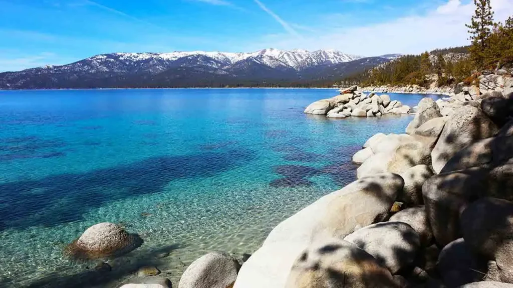
Lake Tahoe’s statistics define the experience. It measures 22 miles long and 12 miles wide. It drops to 1,645 feet at its deepest point, making it the third-deepest lake in North America. Sitting at an elevation of 6,225 feet, it holds a place among the clearest lakes in North America, with historic clarity readings reaching 75 to 100 feet. The basin contains enough water to cover all of California to a depth of 14.5 inches.
The California side holds the most scenically dramatic areas. The west shore along Highway 89 hugs cliffs above the water with minimal development for long stretches. The north shore around Tahoe City provides the best mix of access, lodging, and scenery. The south shore in South Lake Tahoe has the most services and direct beach access.
Summer brings swimming, kayaking, and paddleboarding on water that reaches the low 70s by August. Winter brings lake-view skiing from Palisades Tahoe. This combination of alpine skiing with massive deep-water views remains unavailable at most resorts globally.
While here, a visit to Emerald Bay is necessary. This small inlet sits at Lake Tahoe’s southwestern corner. Most photographers consider it the single most beautiful aquatic scene in California. The bay’s shallow water reads jade green at the edges and deepens to blue at the center. Fannette Island holds a small tea house ruin at its summit. It is the only island located anywhere in Lake Tahoe.
Vikingsholm, a Scandinavian-style stone castle built in 1929 by heiress Lora Moore Knight, sits at the bay’s head. You can access it via a steep one-mile trail from the highway pullout above. The exterior is open to walk around year-round; guided interior tours run in summer.
- Best photography: Dawn from the Highway 89 pullout above the bay. The combination of still water, island silhouette, and first light is one of California’s great sunrise shots. Kayaking into the bay from the state beach launch below provides the closest water-level perspective.
Frequently Asked Questions
Yosemite Valley is the most commonly cited answer and earns it. Nowhere else in the state packs towering granite walls, massive waterfalls, and deep forests into a single, highly accessible valley. That said, Big Sur’s Bixby Bridge corridor and Emerald Bay at Lake Tahoe offer landscapes that rival anything in the American West.
California is famous for entertainment (Hollywood), technology (Silicon Valley), and beaches, but its natural landscape may define the state equally. It holds 9 national parks, placing it high among the most stunning states for outdoor travel. It boasts the world’s tallest trees on the northern coast alongside the world’s most massive trees in the southern Sierra. It also contains the highest peak in the contiguous U.S. (Mount Whitney) sitting less than 100 miles from the lowest point in North America (Badwater Basin).
Yes. Big Sur is one of the most scenically dramatic coastlines in the world. It should be driven slowly with multiple stops. Never use it purely as a fast transit route between Carmel and San Luis Obispo. Allow a full day minimum; two days is better. Prepare for weather variability (summer fog can reduce visibility to almost nothing) and always check Caltrans for road conditions before departure.
Yosemite National Park receives the most consistent endorsement for first-time visitors, particularly for the valley’s combination of scale and accessibility. Sequoia and Kings Canyon together offer a different but equally profound experience centered on the world’s largest trees. Death Valley rewards visitors with the most geological variety in a single park. Redwood National Park offers the most ancient and atmospheric forest. The answer depends on what kind of beauty resonates with the individual traveler.
Lake Tahoe is the most famous and highly justified in its reputation. Its massive size, extreme depth, and year-round recreation options remain unmatched in the state. For pure scenery per square foot, Emerald Bay (technically a Tahoe inlet) is the most beautiful lake scene in the state. Convict Lake offers the most dramatic mountain-to-water composition. Mono Lake provides the most unusual and otherworldly landscape of any lake in California.
While Yosemite and Tahoe draw millions, lesser-known spots offer equal beauty with a fraction of the crowds. Point Lobos State Natural Reserve packs incredible marine biodiversity into a tiny coastal footprint. Channel Islands National Park requires a boat trip but rewards visitors with rare wildlife found nowhere else on earth. Pfeiffer Beach in Big Sur requires navigating an unmarked road but delivers unique purple-tinged sand and perfect sunset alignments.
Fall (September-October) offers the best combination of weather, manageable crowds, and natural beauty across most of the state. Spring (April-May) delivers peak waterfall flow at Yosemite and comfortable hiking temperatures in the deserts. Summer is ideal for Lake Tahoe water sports and exploring the high country of the Sierra Nevada. Winter serves as the prime season for exploring Death Valley or whale watching off the Monterey coast.
Conclusion
California doesn’t ask you to choose between landscapes. It simply asks how much time you have. A single state holds the world’s tallest trees and the continent’s geographical basin. You can swim in an alpine lake with 70-foot water clarity on Tuesday, then hike a desert that receives two inches of annual rain.
The mistake most first-time visitors make is trying to cover too much. California rewards depth. Three full days in Yosemite reveals something a single day cannot. Two nights in Big Sur means seeing both the morning fog burn off the cliffs and the evening light turn the sea stacks gold. A slow drive up Highway 395 along the eastern Sierra in October, when the aspen groves are burning gold against the granite, is not something that works as a drive-by.
Build your itinerary around two or three landscapes that genuinely interest you. Choose between coastal cliffs, alpine lakes, ancient forest, volcanic terrain, or desert geology. Plan to spend real, uninterrupted time in each place. California’s most beautiful places rarely reveal themselves to visitors rushing through on a tight schedule. They reward those who stop, look twice, and return the next morning for better light.
Whatever your focus, the state delivers. The beautiful places in California are not overhyped. Most of them look exactly as good as the professional photographs suggest. Catch them on a clear October morning when the roads are empty, and they look even better.